How Drones Are Helping in Environmental Conservation
Drones, once primarily used for military and surveillance purposes, have rapidly become a valuable tool in the field of environmental conservation. These unmanned aerial vehicles (UAVs) are now being harnessed to monitor ecosystems, protect wildlife, manage natural resources, and gather critical data for research and restoration efforts. With their ability to access hard-to-reach areas, capture high-resolution imagery, and provide real-time data, drones are transforming how environmentalists approach conservation and sustainability challenges. Here’s a look at the various ways drones are helping in environmental conservation.
1. Wildlife Monitoring and Anti-Poaching Efforts
One of the most important applications of drones in environmental conservation is in wildlife monitoring and anti-poaching efforts. In regions where poaching and illegal hunting are major threats to endangered species, drones provide a safe, non-invasive method to monitor vast areas of land. Equipped with high-definition cameras, thermal imaging sensors, and even night-vision capabilities, drones can track animal movements, monitor wildlife populations, and detect any unusual activities, such as the presence of poachers.
Drones can fly over protected areas like national parks or wildlife reserves, scanning large territories more efficiently than traditional ground patrols. They can also be deployed quickly and discreetly, making it harder for poachers to spot them. Additionally, drones equipped with GPS tracking systems can help create detailed maps of habitats, monitor migration patterns, and gather data on animal health, all of which are vital for species protection and management.
2. Habitat Mapping and Ecosystem Monitoring
Drones are playing a key role in mapping and monitoring ecosystems, providing valuable data on the health and status of forests, wetlands, grasslands, and coastal areas. Using various sensors like LiDAR (Light Detection and Ranging) and multispectral cameras, drones can capture highly detailed images and topographic data to assess vegetation health, deforestation, land degradation, and changes in biodiversity over time.
For example, drones can be used to assess the effects of deforestation or track changes in forest canopy coverage, offering a more efficient and cost-effective alternative to traditional satellite imaging. In coastal regions, drones help monitor coral reefs, track the impacts of ocean pollution, and observe the movement of marine animals, providing essential data for marine conservation efforts. This real-time data allows conservationists to respond more quickly to environmental threats and plan more effective conservation strategies.
3. Reforestation and Habitat Restoration
Reforestation and habitat restoration efforts are crucial in mitigating the effects of climate change and preserving biodiversity. Drones are helping to speed up these efforts in several ways. For example, drones can be used to plant trees and vegetation in areas that are difficult to access by human workers. This process, known as “drone-assisted reforestation,” involves drones dropping seed pods or young saplings into deforested or degraded areas, which can accelerate the restoration of ecosystems.
Some innovative drone systems are equipped with seed-planting mechanisms that fire seed pods into the ground, allowing for large-scale planting in remote or challenging terrain. By automating this process, drones are able to plant trees in a fraction of the time it would take traditional methods, while also reducing human labor costs and minimizing the environmental impact. This technology is especially valuable for restoring ecosystems after natural disasters or human-induced deforestation.
4. Monitoring Climate Change and Environmental Changes
Drones are helping scientists better understand and track the effects of climate change by providing real-time data on environmental changes in vulnerable regions. From melting glaciers to rising sea levels, drones are able to collect detailed, up-to-date data on climate-related changes that are often difficult or dangerous for humans to access.
For instance, drones equipped with infrared sensors can monitor temperature fluctuations in forests, wetlands, and oceans, helping to track the impacts of climate change on these ecosystems. Drones can also be used to measure air quality, track carbon emissions, and gather data on the impacts of extreme weather events such as floods, droughts, or wildfires. This data is invaluable for scientists and policymakers who are working to understand the full scope of climate change and implement mitigation strategies.
5. Environmental Education and Awareness
Drones are also being used to raise awareness about environmental issues by providing dramatic aerial footage of natural landscapes, wildlife, and the effects of environmental degradation. Documentaries, media campaigns, and educational programs often utilize drone footage to capture the beauty of nature and the urgency of protecting endangered species and habitats.
By providing captivating and high-quality images of remote and otherwise inaccessible areas, drones help engage the public and raise awareness about pressing environmental issues. Aerial views of deforestation, wildlife poaching, or polluted water bodies can inspire action and encourage governments, organizations, and individuals to take steps toward environmental conservation.
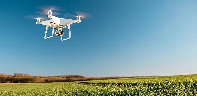
6. Precision Agriculture and Sustainable Farming
While drones are commonly associated with conservation efforts in natural habitats, they are also making a significant impact in sustainable agriculture. Precision agriculture—where drones are used to monitor crop health, soil conditions, and irrigation needs—is helping farmers reduce resource usage, minimize waste, and promote more sustainable farming practices.
Drones equipped with multispectral sensors can monitor plant health by detecting signs of disease or nutrient deficiencies, allowing farmers to address issues before they become widespread. Drones can also monitor water usage, ensuring that crops receive optimal irrigation, thereby conserving water and reducing waste. This approach promotes more efficient farming, reduces the environmental impact of agriculture, and helps conserve natural resources.
7. Assessing and Managing Natural Disasters
In the aftermath of natural disasters, drones are proving to be an invaluable tool for conservationists and first responders. Whether it’s after a wildfire, earthquake, flood, or hurricane, drones can quickly assess damage, identify vulnerable areas, and map the extent of environmental destruction. This rapid assessment helps emergency teams prioritize efforts and deploy resources effectively for disaster recovery.
Drones are also being used in post-disaster monitoring to ensure that ecosystems affected by disasters, such as wildfire-ravaged forests or flood-damaged wetlands, are properly managed and restored. By quickly identifying areas of concern and assessing the success of restoration efforts, drones contribute to faster recovery and more effective long-term conservation strategies.
Conclusion
Drones are revolutionizing environmental conservation by providing efficient, cost-effective, and non-invasive methods for monitoring ecosystems, protecting wildlife, and managing natural resources. From wildlife surveillance and reforestation efforts to habitat restoration and climate change monitoring, drones are helping conservationists collect real-time data and respond more effectively to environmental threats. As drone technology continues to advance, it will play an even greater role in promoting sustainability, protecting biodiversity, and mitigating the effects of climate change. With their versatility and growing capabilities, drones are indeed flying high as indispensable tools in the fight for a healthier, more sustainable planet.


ok
I value your ability to simplify intricate concepts into accessible portions.
This blog is well-researched. I enjoy the extent of knowledge you share.
5wkir6
Interesting read! Analyzing past performances and understanding the platform – like the localized approach at jiliday casino – seems key to successful betting. Secure, engaging environments matter! 🤔
mlpw7w